If you’ve followed my previous blogs, you probably recall that our first date was hiking at Trinity Park near Cairns, Queensland. It’s my go-to activity on the weekend or after finishing the day. So naturally, when we relocated to the south, we wanted to discover the walking trails around town.
We’ve tried out a few hikes and would like to share some of the best hikes around Adelaide, particularly for beginners and intermediate hikers. If you’re looking for an easy, scenic walk within the city, check out the trails along River Torrens or around the Parklands. It’s pretty flat and a pleasant distance to stroll. However, if you’re up for a challenge, I reckon to give Waite loop or Waterfall Gully to Mt Lofty a shot.
The longest hiking trail in South Australia
I’ve heard about the Heysen trail, which is the longest hiking trail in South Australia. The total hike is about 1,200 kilometres. The trail starts from Cape Jervis, taking you along beaches and cliffs, through Adelaide Hills, and Flinders Ranges, and eventually ending at Parachilna Gorge.
When we hiked in the hills, our path would often merge with the Heysen Trail. I’m still amazed just thinking about those who’ve completed this incredibly lengthy trail. It reminds me of the movie “Wild,” based on a true story, where the main character, Cheryl, attempts to piece her life back together by finishing the Pacific Crest Trail. That’s the power of nature, not just seeing it, but walking and immersing ourselves in it. The stillness of the air provides time for reflection and the opportunity to find peace and understand yourself.
Waite Conservation Reserve Loop Walking Trail
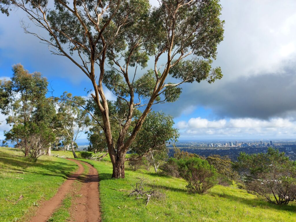
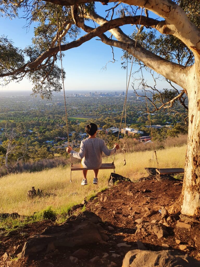
This was the first hike in Adelaide that Greg and I did together. It begins with a steep climb leading to the top point, where you can look behind and see the valley view with the cityscape in the distance. Have a break to catch your breath, then continue through the trail along the trail through grassy woodland and rolling hills. If you’re lucky, you might spot Kangaroos or Koalas around while you walk to the lookout. Nearby, it used to be a swig under a tree, but it was gone the last time we were there.
Just about 15 mins from the CBD on Cross Road, then turn onto Waite Road and take a left to Hartley Groove to the end and park there.
- Distance: 4.2 km circuit
- Duration: 2-3 hours
- Difficulty: Moderate
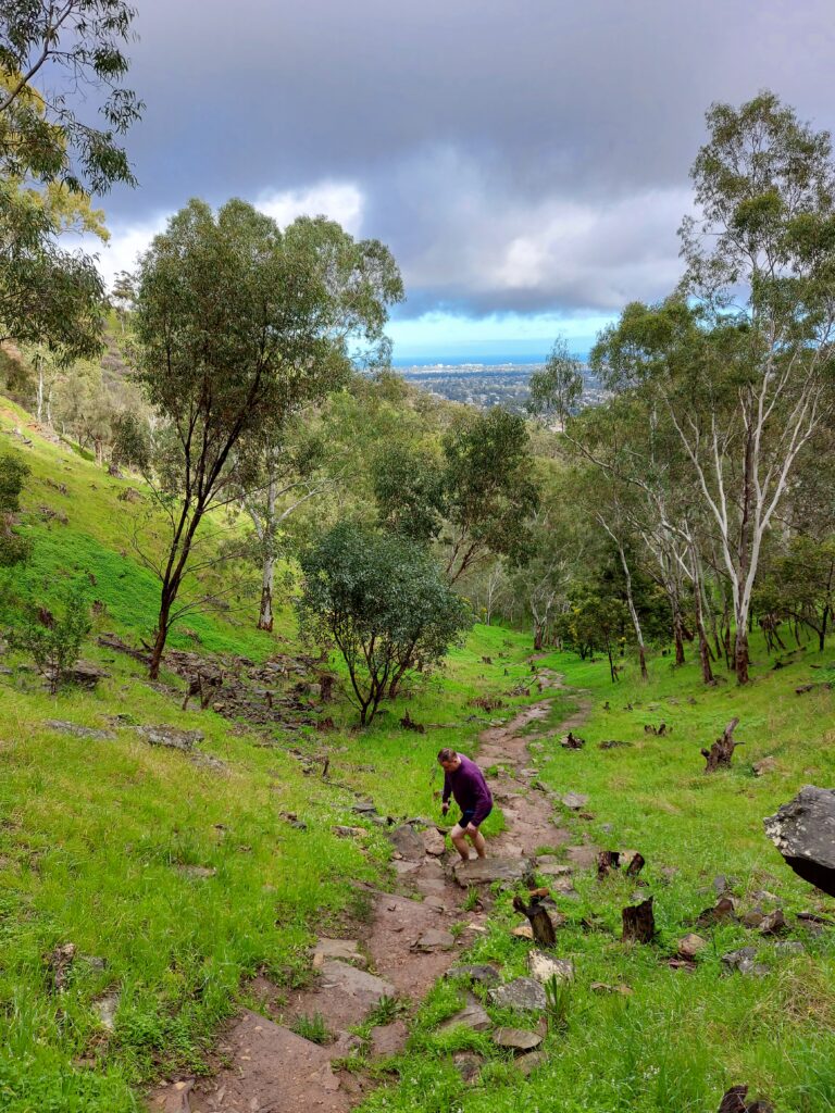
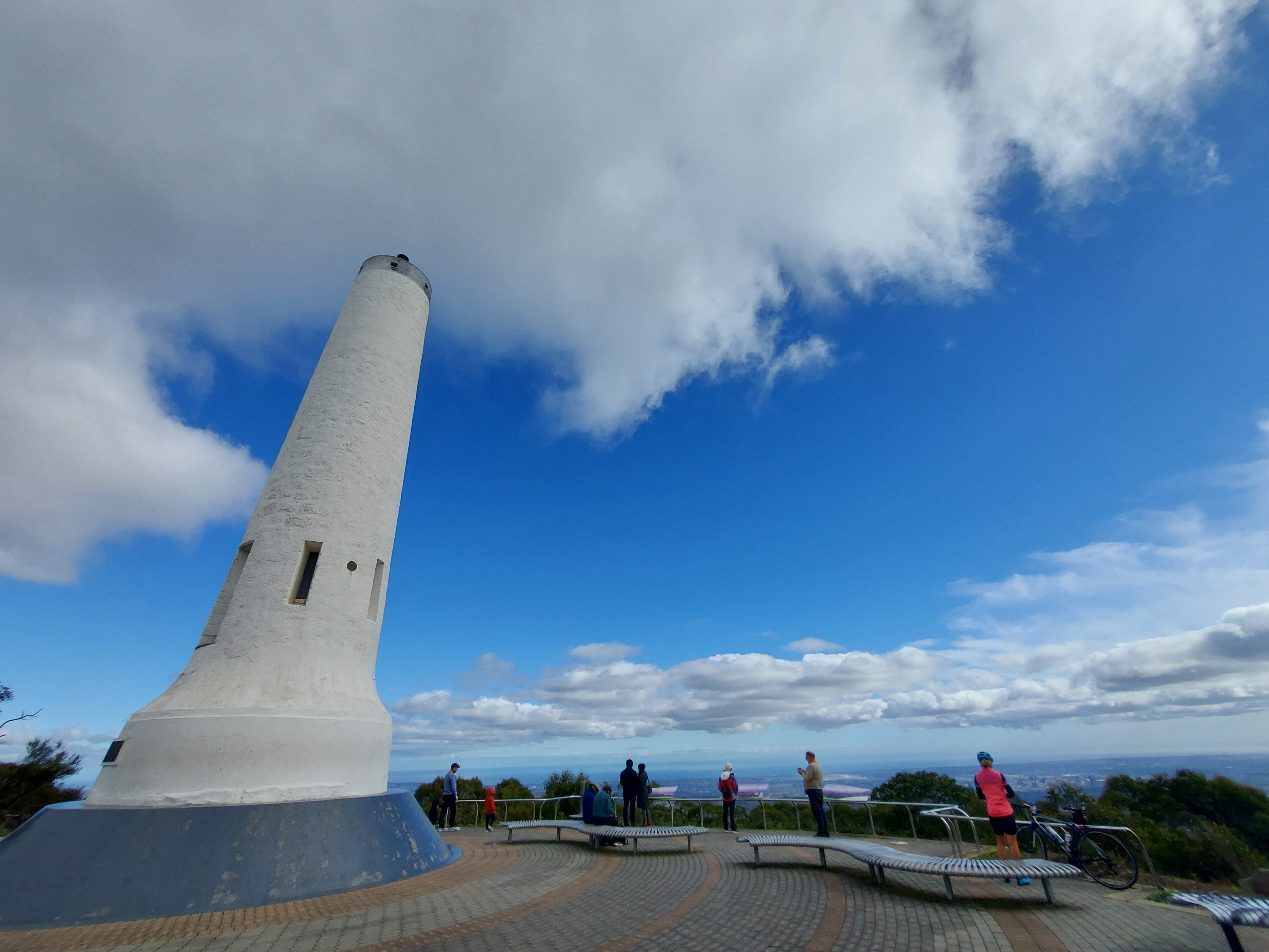
Waterfall Gully to Mt Lofty Summit Hike
Greg convinced me to try this hike during summer, but I wasn’t too keen after looking at the map. It’s a return hike and I usually prefer circuit ones. The distance seemed a bit too much for me as well. However, when winter came, I thought it might be a good way to keep my body warm.
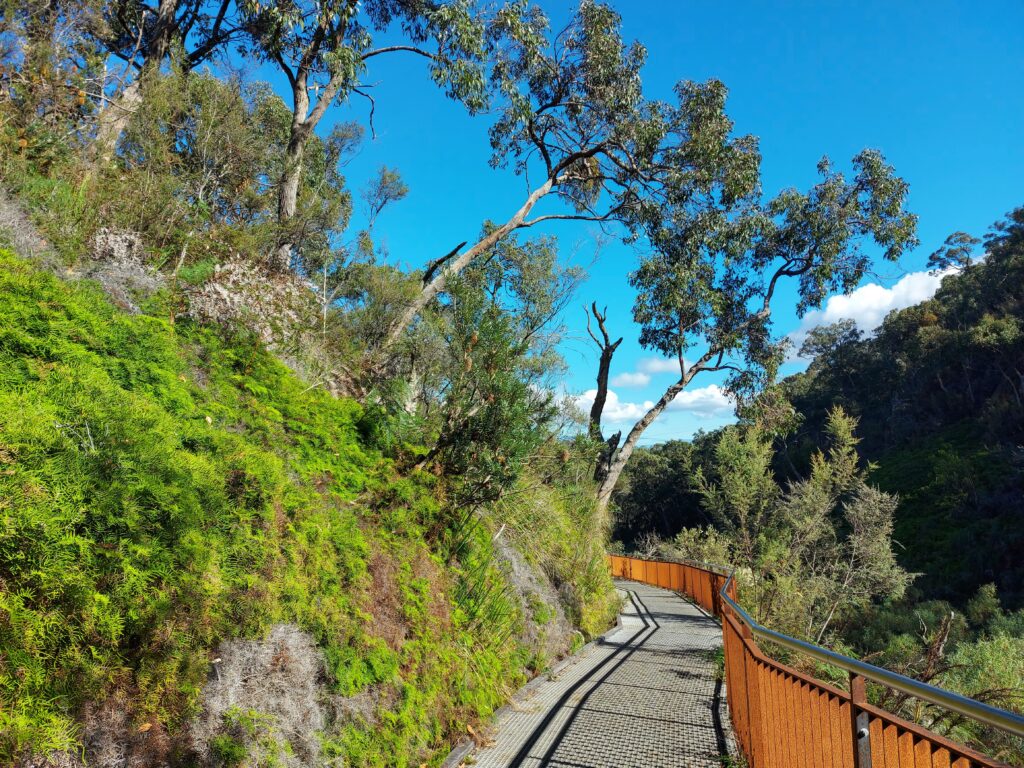
We started from the Waterfall Gully, climbing the steep paved track up to the top of the waterfall. Then we followed the little creek and stopped for a photo at the Second Falls before heading uphill again. There are a few interesting spots to explore, like Chinamans Hut, Wilsons Bog and even tiny waterfalls running under the walking path. This area reminded me of Tasmania.
Then the last steep part felt like it would never end before we finally reached the YHA hostel hut. Be prepared and take your time, as it’s pretty tough and challenging. I sweated and huffed a bit but kept going, crossing Mount Lofty Summit Road and finally got to the top of Mount Lofty. On the way down was easier and faster.
From the CBD, driving to Waterfall Gully is about 15 minutes. There is plenty of parking, though it could be packed on busy weekends.
- Distance: 7.8 km return
- Duration: 1.5-3 hours
- Difficulty: Hard
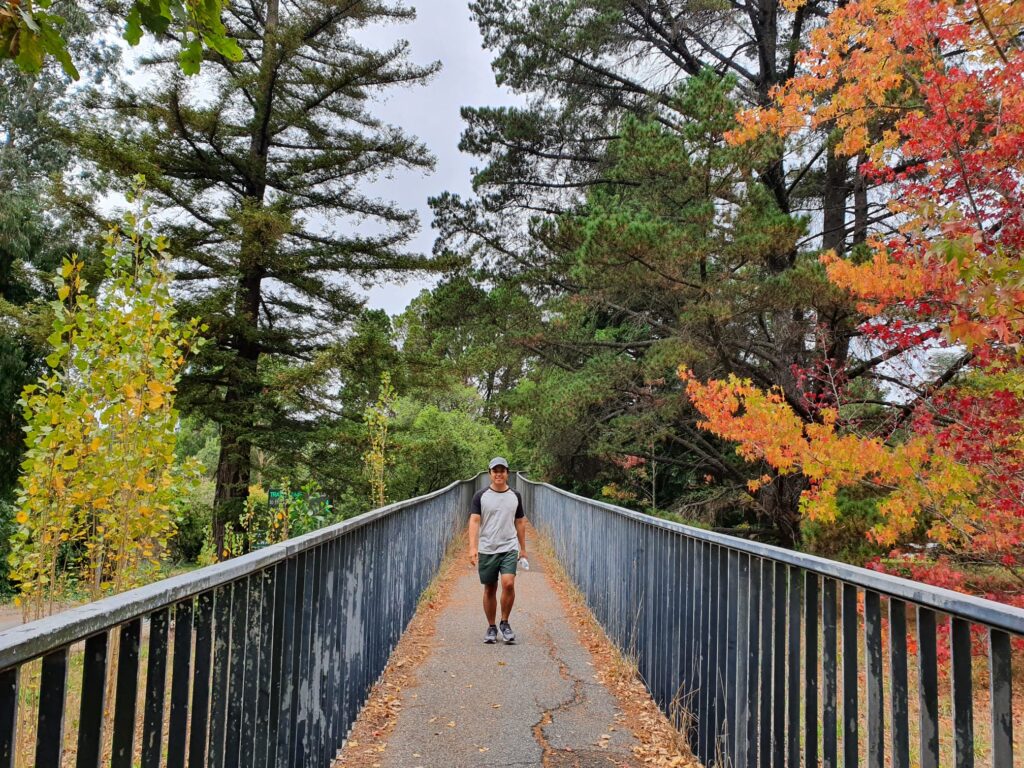
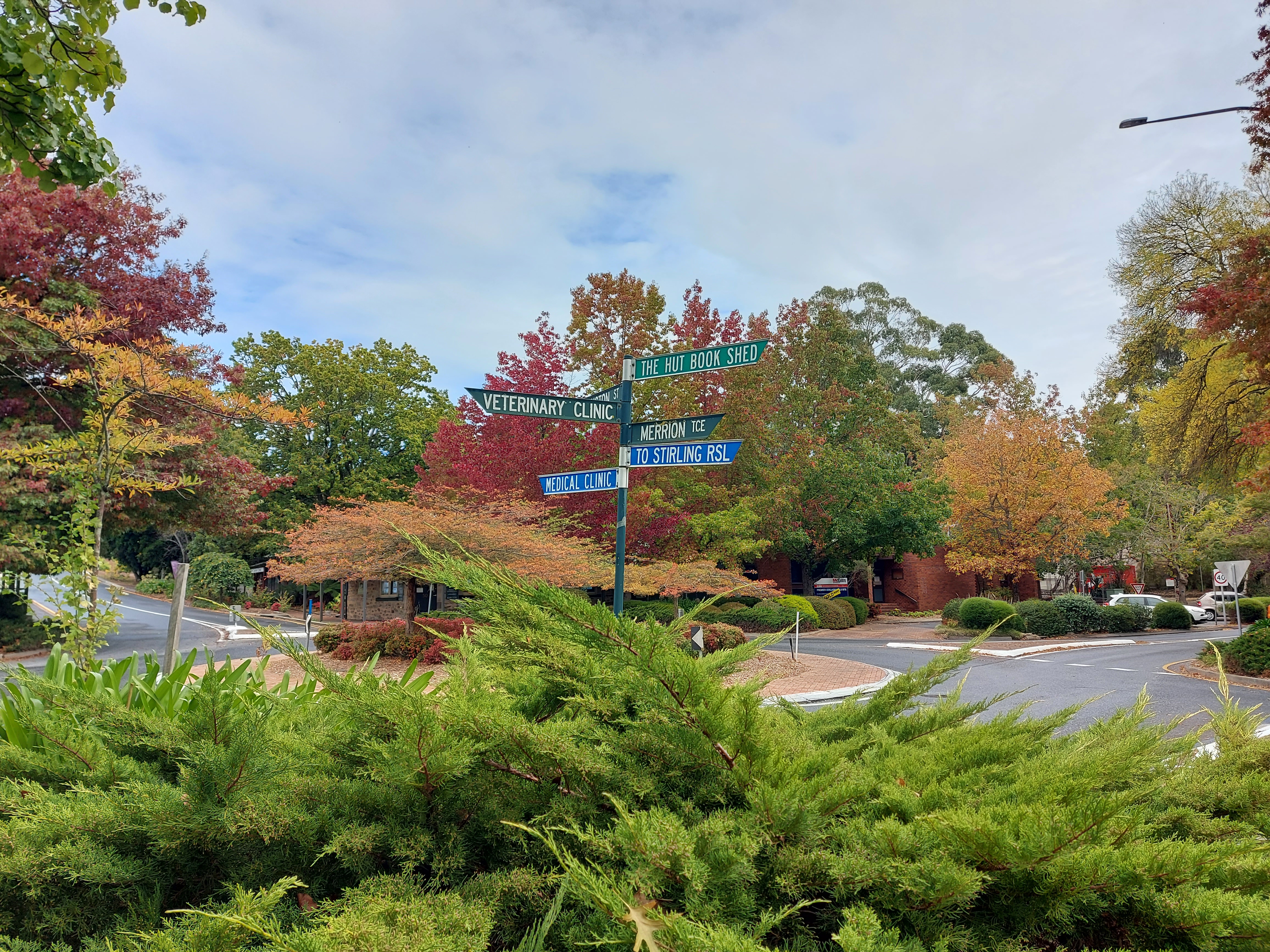
Crafers – Stirling Circuit
This is the easiest hike on the list today. It’s more like a chilling walking track than an adventurous hike. I highly recommend coming here in autumn when the changing colours create a stunning backdrop throughout the circuit.
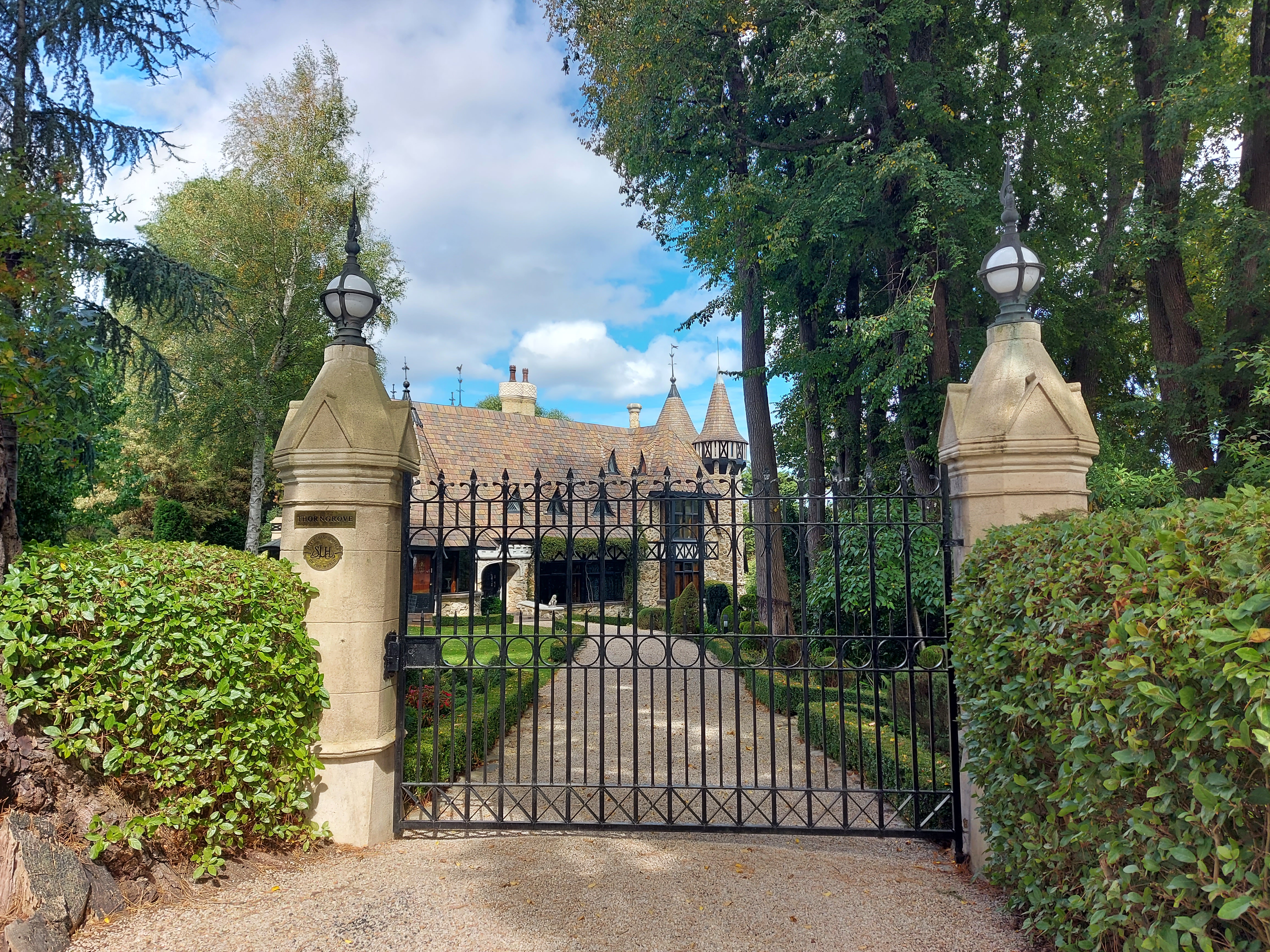
Starting from Crafers, then meandering along the country lanes and reserves before reaching Stirling and looping back through the picturesque residential area. You’ll be amazed at the gorgeous historic houses in the area, every one of them looks so grand! There are huge mansions with an indoor pool. Are you serious? And wait till you walk past the Thorngrive Manor Hotel. It’s jaw-dropping, who would think that in a little town like this would be an enormous castle that looks like pop out from a Disney movie scene. It’s a very impressive and easy walk.
Heading out of the city about 18 minutes on Princess Highway before turning off to Crafers. Park your car at the bus stop, and from the roundabout, start your walk by crossing the bridge to another side of the highway.
- Distance: 4.2 km circuit
- Duration: 1-2 hours
- Difficulty: Moderate
Now, let’s venture a bit further from town, immersing ourselves in even more breathtaking beauty as we get closer to nature.
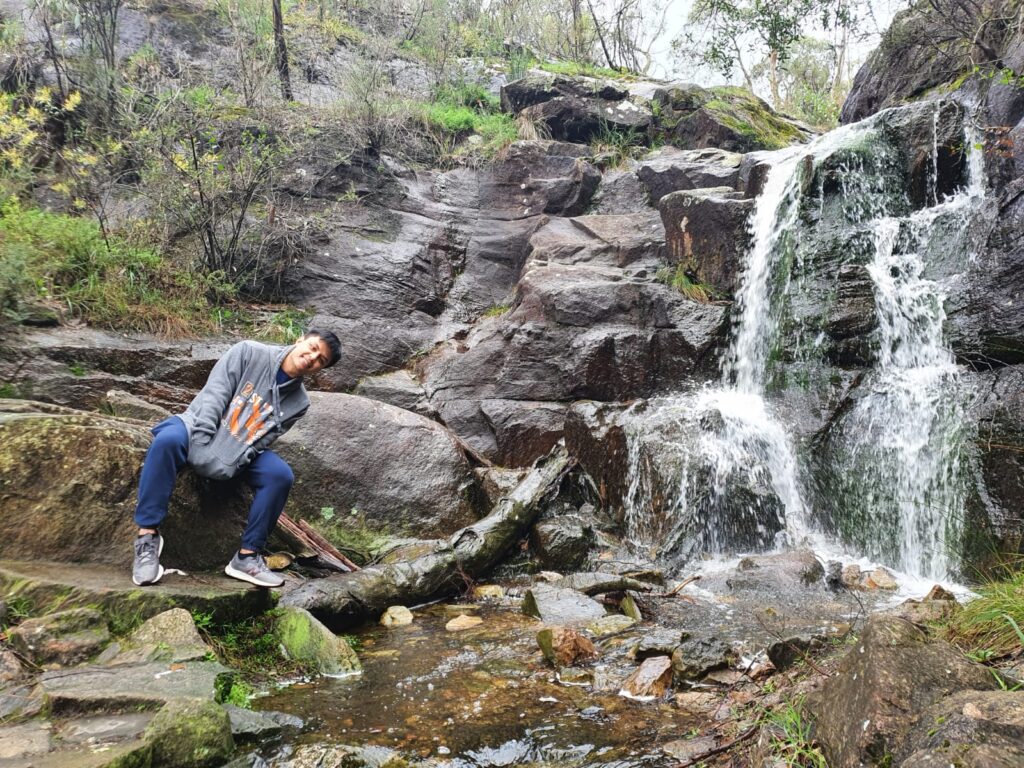
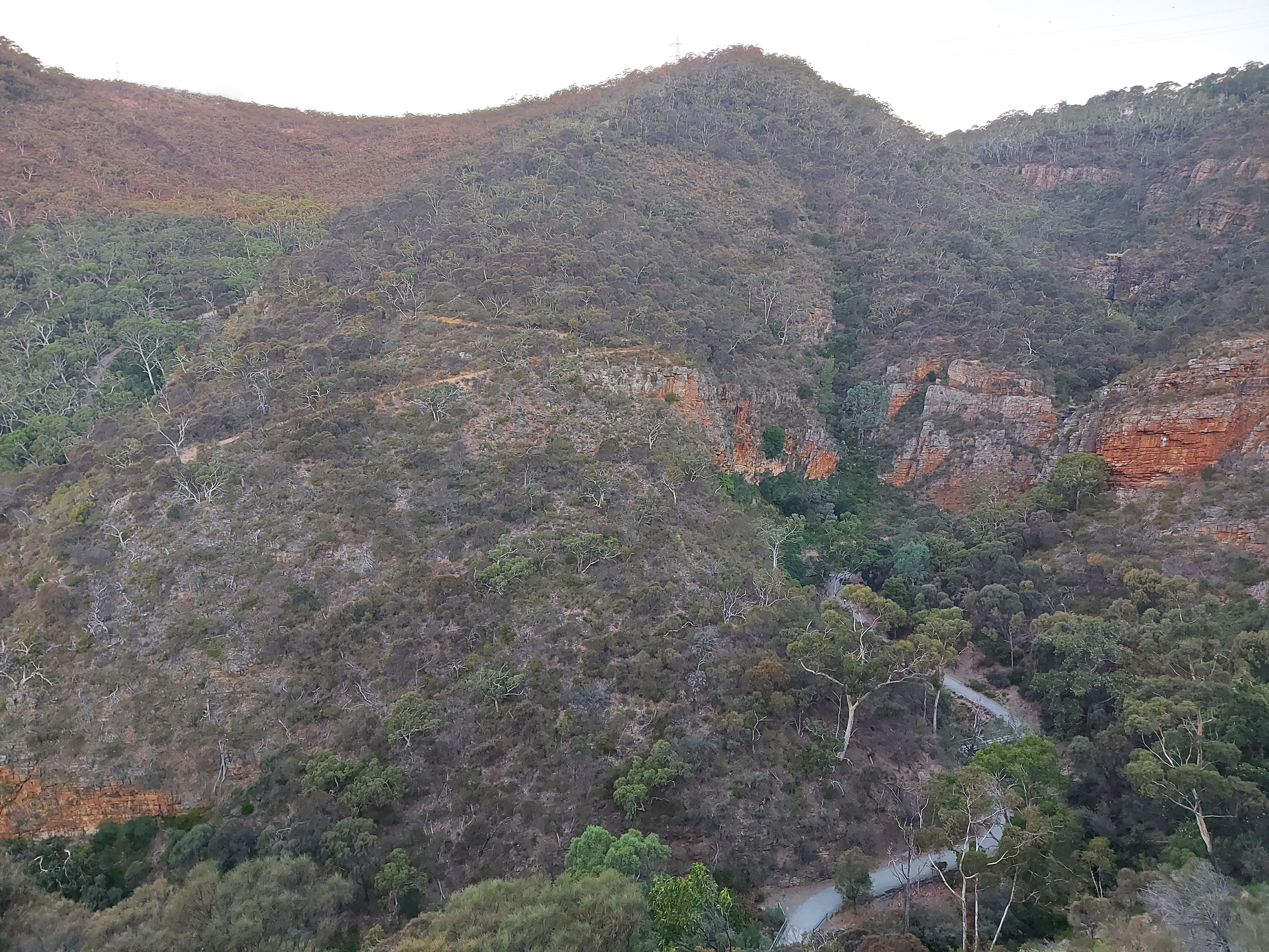
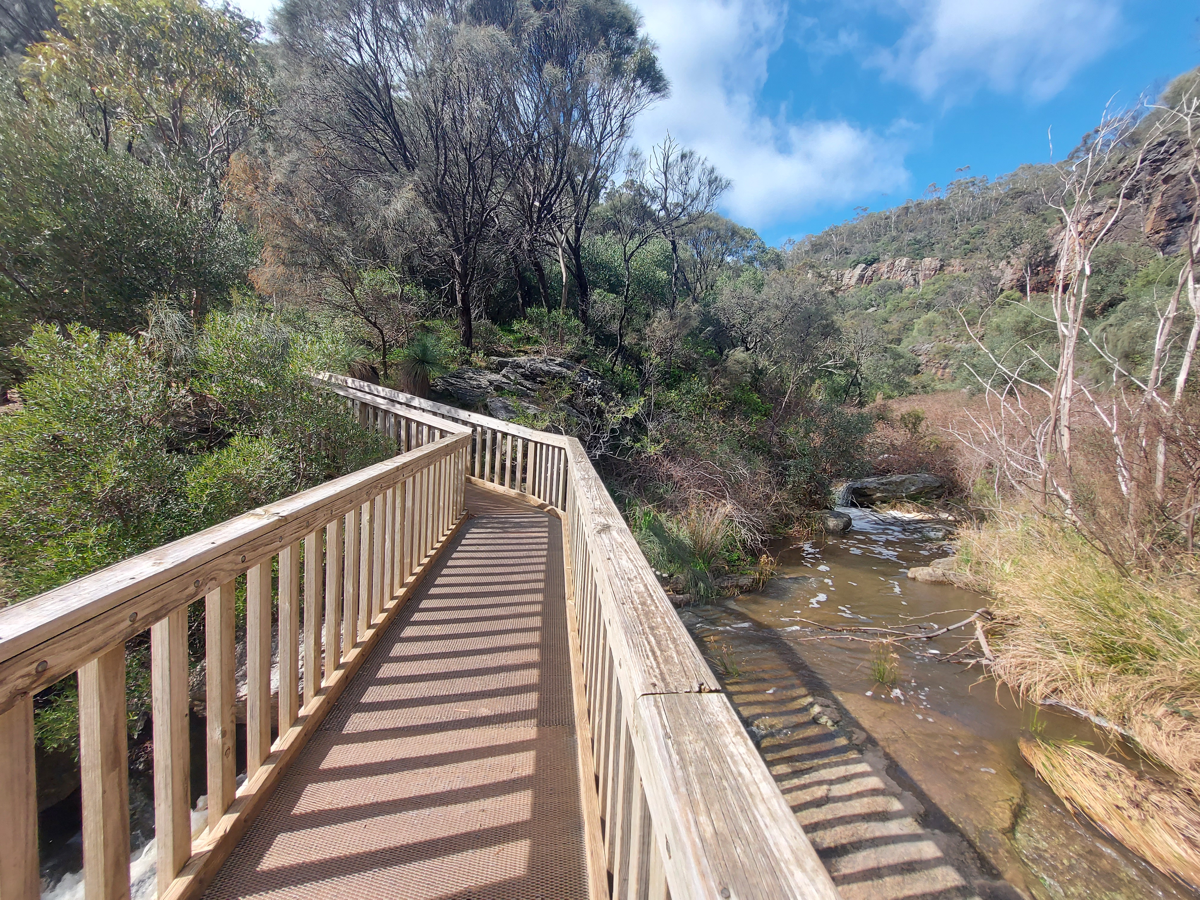
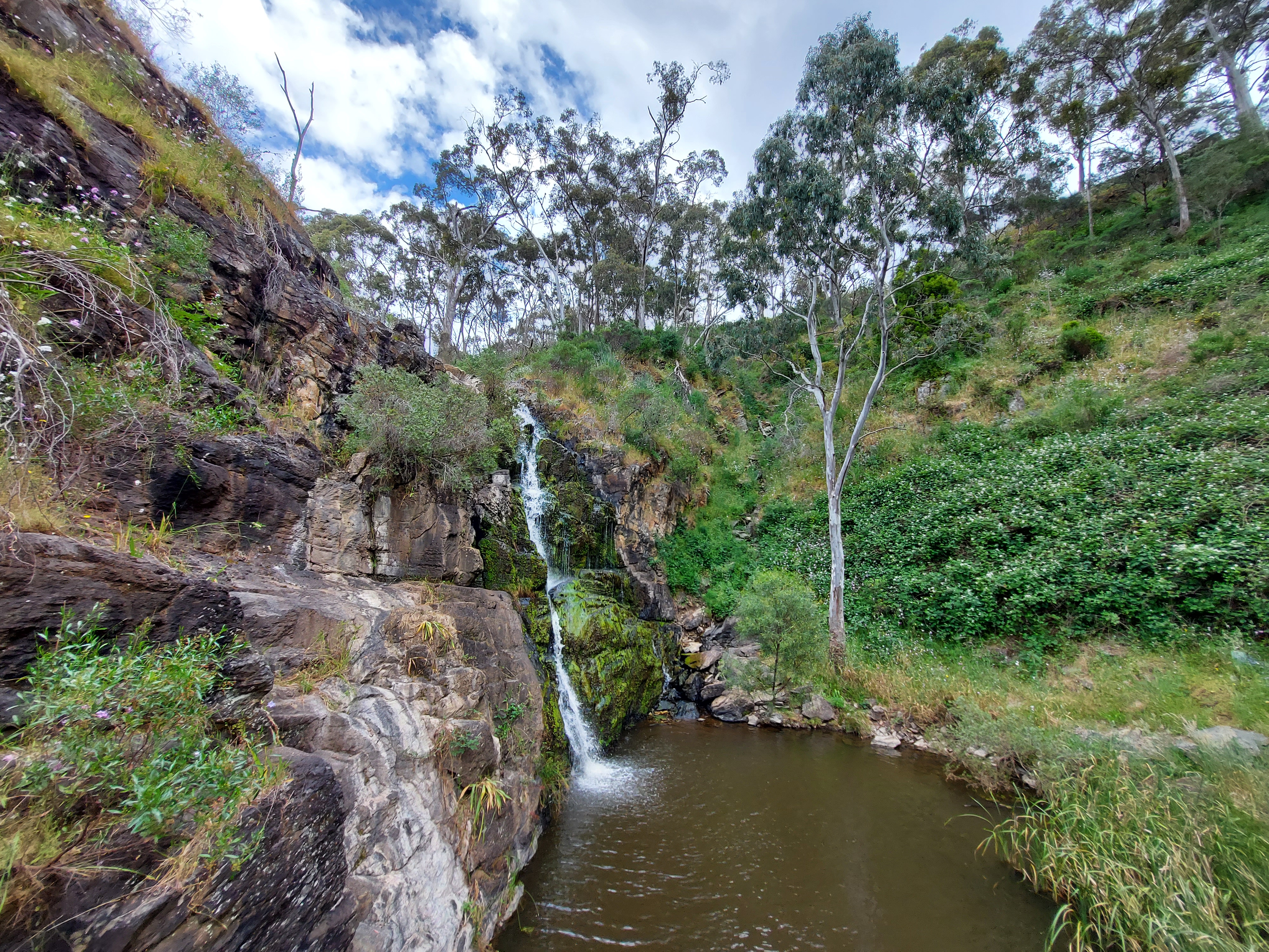
Three Falls Hike – Morialta Conservation Park
There are about five different hikes around Morialta you can choose to do. We probably did two or three of them. However, my favourite is the Three Falls Hike because the path takes you around the edge of the gorge, showcasing the spectacular views of the red cliffs. Plus, the sounds of water flowing and cascading accompany you as you walk, with a few lookouts at the top of First and Second Falls before reaching the hidden Third Falls.
The return journey also offers incredibly breathtaking views over Morialta Gorge, making you feel like a tiny speck amidst this masterpiece of nature. We’ve been here quite a few times and spotted wild koalas almost every time. So, if you’re a fan of these fluffy little things and enjoy being active, this is a perfect way to do it.
Drive to the east from the city around 20 minutes to Morialta Conservation Park or catch bus routes H30S and H33. Once you arrive, walk through the park along the creek to reach the car park, which serves as the starting point for all the hikes in the area.
- Distance: 7.3 km return
- Duration: 3.5 hours
- Difficulty: Moderate
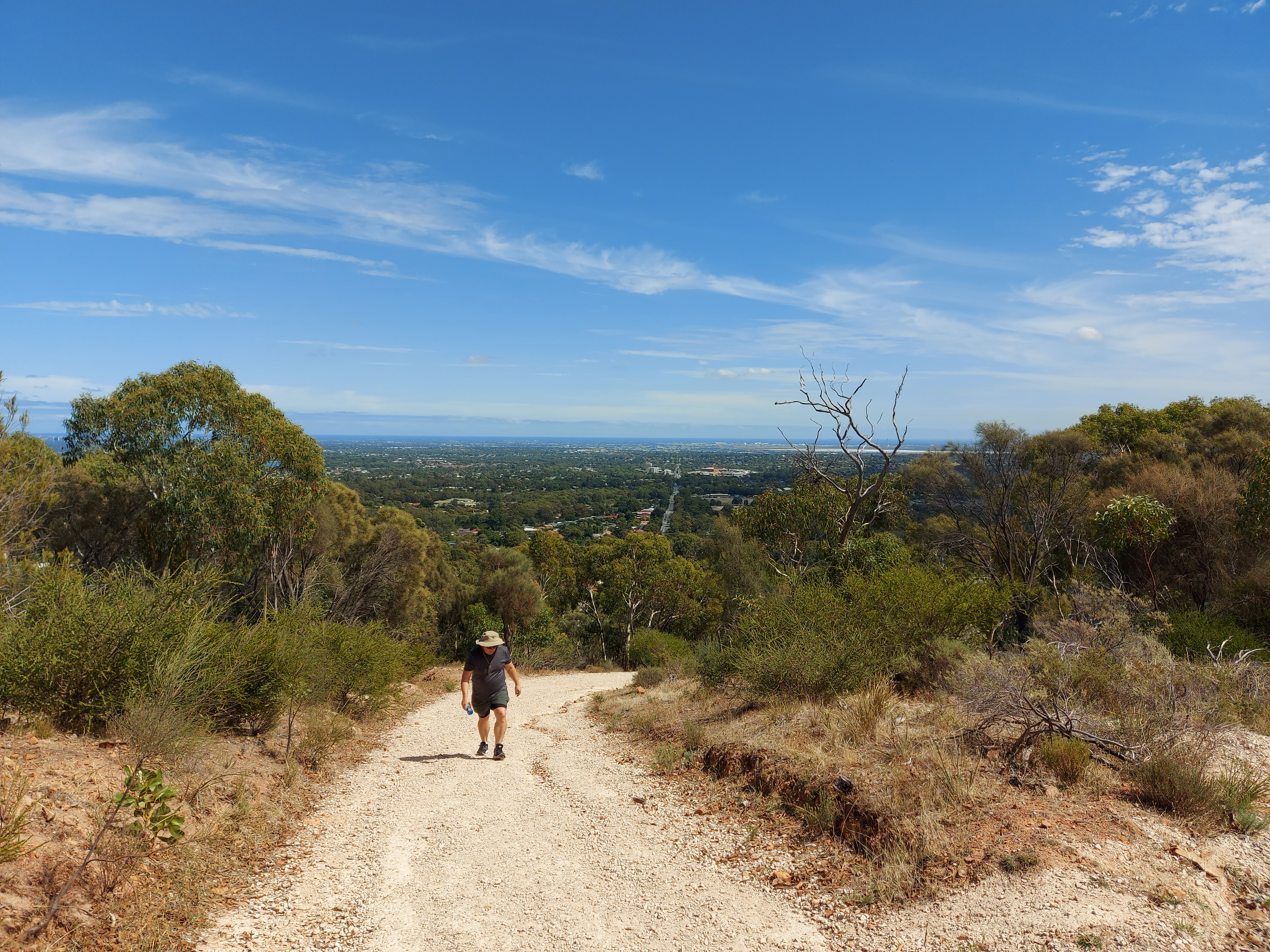
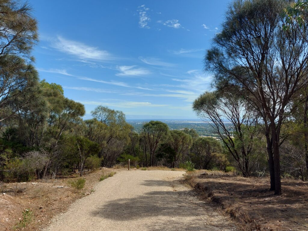
Pink Gum Loop – Anstey Hill Recreation Park
The funny thing is that we went to Anstey Hill Recreation Park and looked at the map, thought Pink Gum Loop seemed like the shortest and easiest trail for us to complete. We started nicely from Gate 3, following the Yellowtail Loop before turning on the second right to the Pink Gum Loop. From there, it’s a constant uphill trek for half the trail. We even had to stop a couple times to catch our breath. With limited shade along the path, the sun made the climb even more challenging. However, once we reached a certain height, we were rewarded with the stunning view of a straight road cutting through the suburbs all the way to the ocean. It’s actually worth our sweat.
On the way back, we enjoyed a downhill journey through shadier terrain. But do watch out for snakes if you come here during summer. I nearly stepped on a brown shake camouflaged in a pile of sticks and dry leaves.
This is a bit away from the city to the northeast suburbs. There are several entry points, but we drove from the city, about 30 minutes to Vista and entered through Gate 6.
- Distance: 3.1 km return
- Duration: 1.5 hours
- Difficulty: Hard
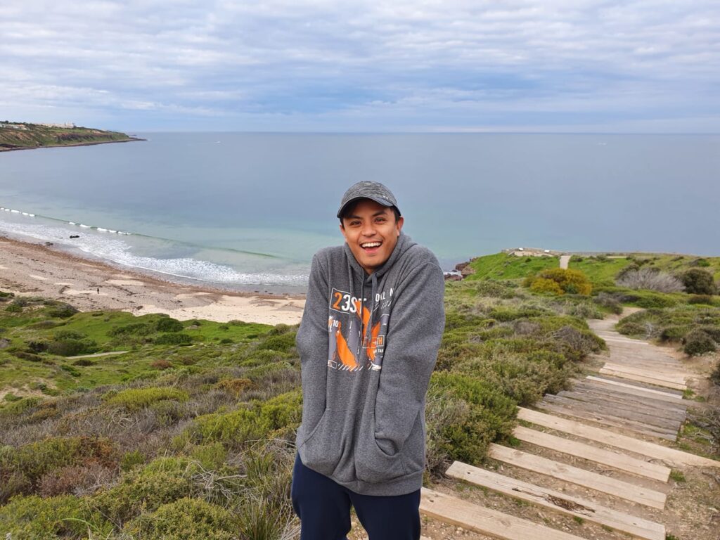
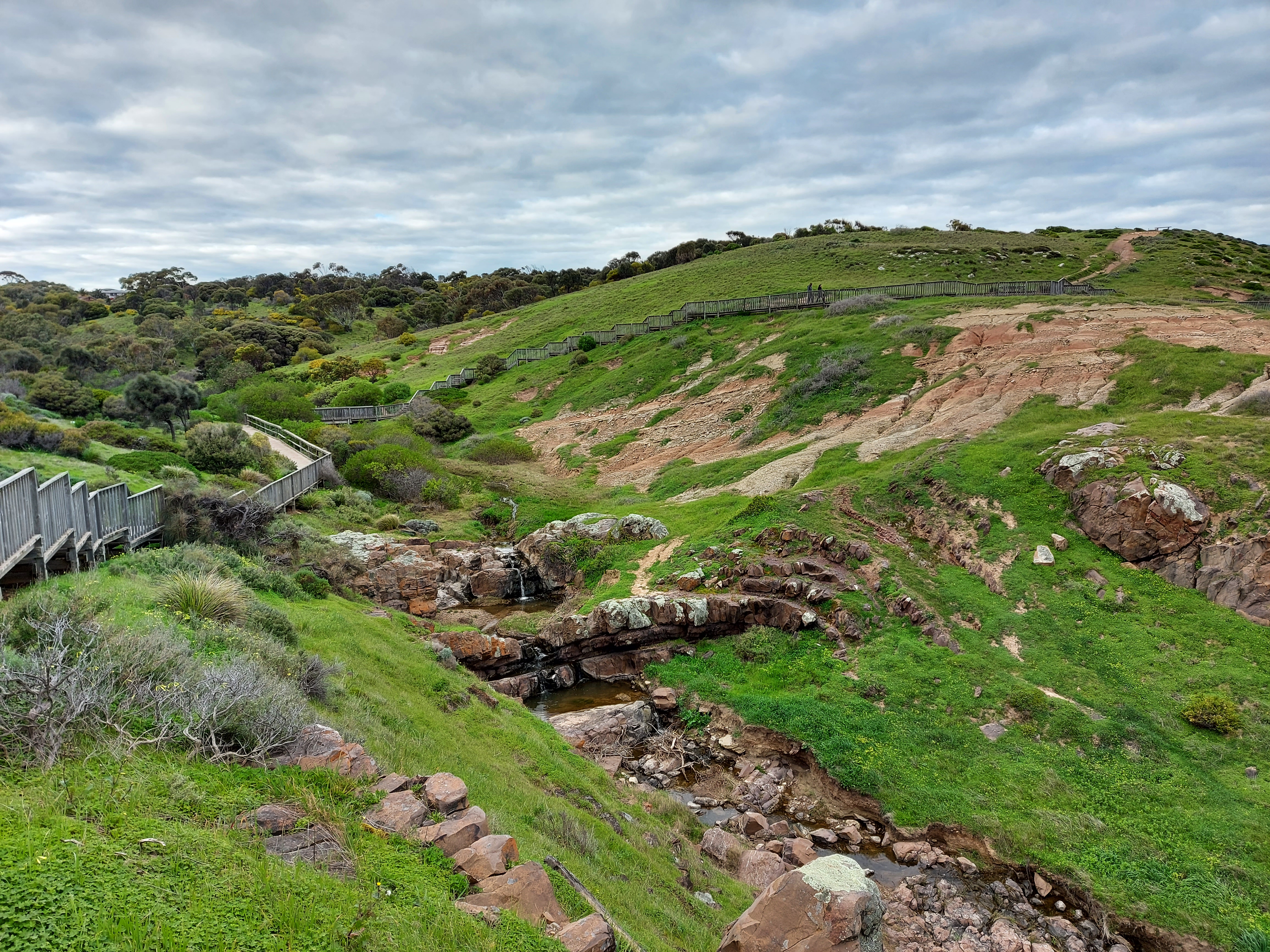
Hallett Cove Boardwalk (Marion Coastal Walking Trail)
This is a must-visit spot for anyone coming to South Australia. This gorgeous coastal walk offers breathtaking ocean views, natural sculptures like Sugarloaf, rugged cliffs, and rocky reef platforms. The walk from Hallett Cove is mostly flat and safe. Then it gets a bit hilly as you continue to walk up on the boardwalk through Sugarloaf to the coastline. However, it’s a nice and easy walk if you dislike the city view and prefer somewhere close to the ocean.
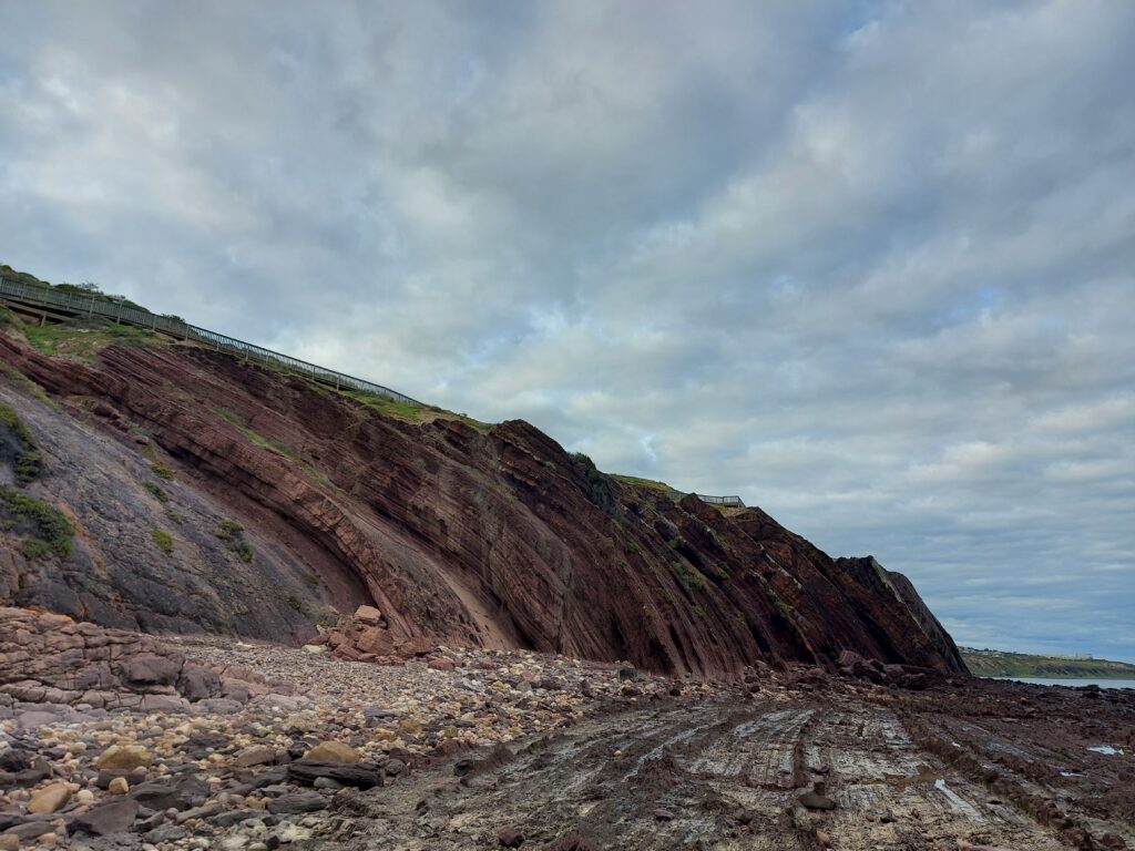
It’s about 30 minutes to the south using Southern Expressway to Hallett Cove. You’ll find parking available at Hallett Cove or Burnham Road if you prefer to start from the Marino suburb.
- Distance: 5.1 km one way
- Duration: 1.5-2 hours one way
- Difficulty: Moderate
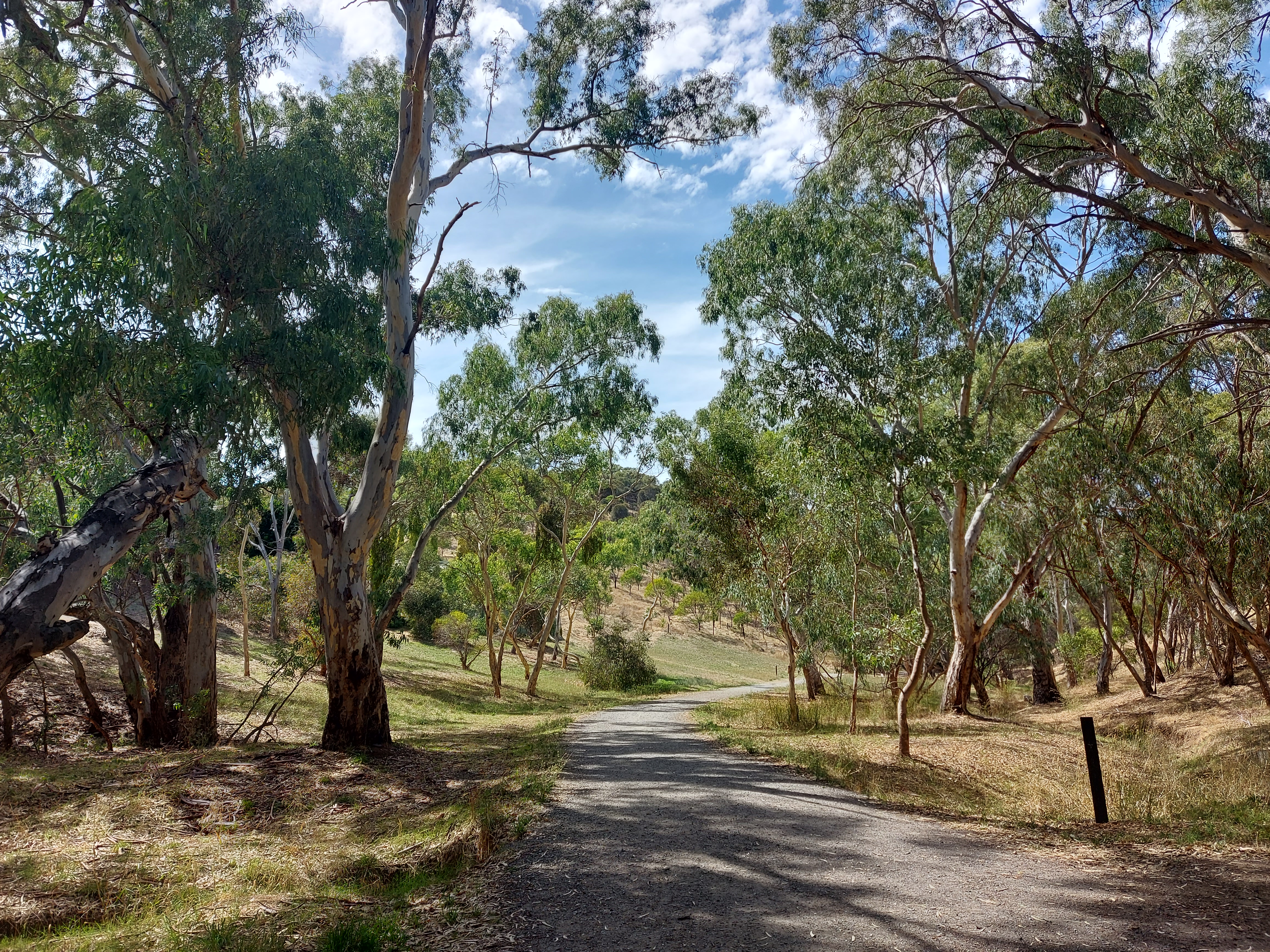
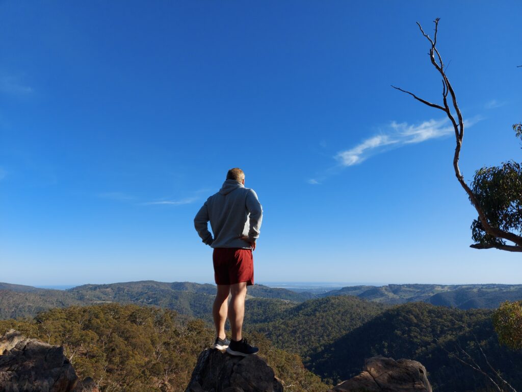
Montacute Conservation Park Hike
This hike is actually my favourite so far. Driving along Valley Road, you’ll be surrounded by towering trees and a babbling creek, making you feel like you’re entering a lush, deep forest. Once you cross the small bridge over the creek, continue to the end and park near Gate 1 to start the hike.
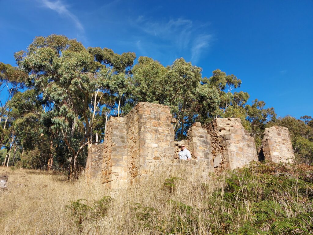
Like most hikes, it begins with a steep uphill track along the Heysen trail, but the higher the climb, the more beautiful the forest landscape becomes. There are also the ruins of the old house nestled in the middle of the bush. While the path is pretty well marked, I suggest you look at the map or GPS, as it’s easy to lose your way onto other trails.
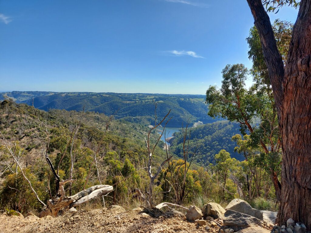
Throughout the hike, you’ll pass through several gates until you reach an information board. From there, head downhill on Stone Hut Road, where you’ll see the gorgeous view of Kangaroo Reservoir at the bottom of the surrounding hills. On the way back to the carpark, keep an eye on koalas, and once, I even saw wild goats scampering away.
Getting to Gate 1 at Montacute Conservation Park Hike takes about 40 minutes from the city. Head northeast on Montacure Road, turn to Corkscrew Road and enter the forest via Valley Road. Drive straight to the end to begin the hike.
- Distance: 6.3 km return
- Duration: 2 hours
- Difficulty: Challenging
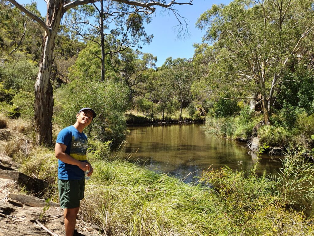
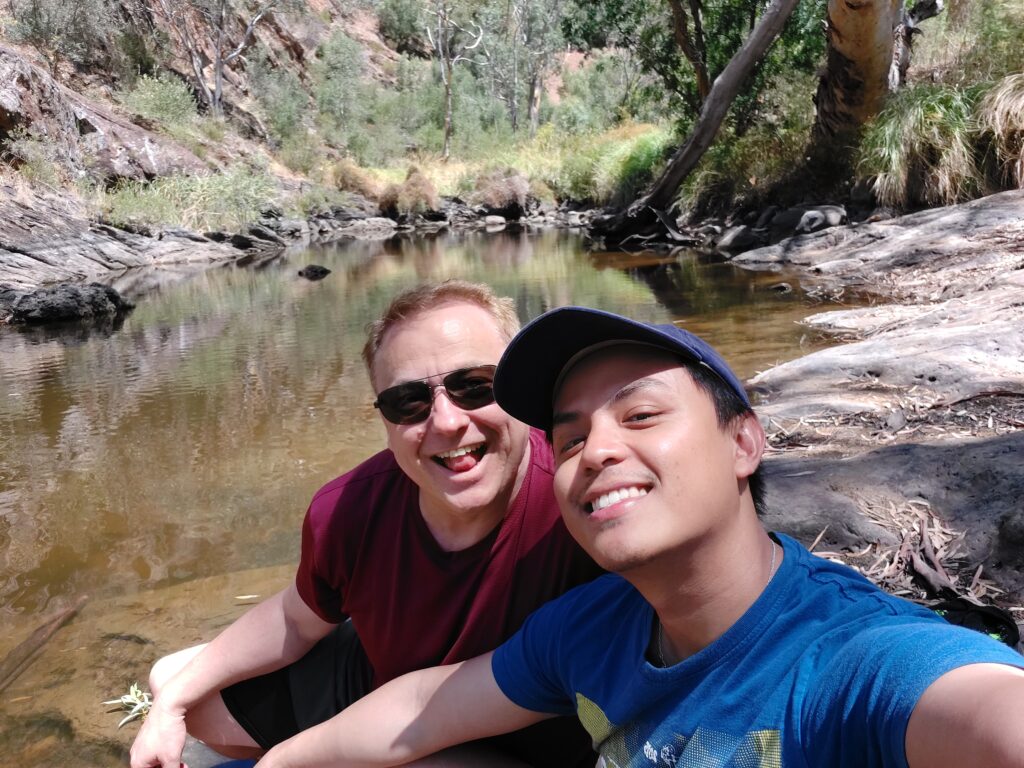
Gorge Hike/Sundews River – Onkaparinga River National Park
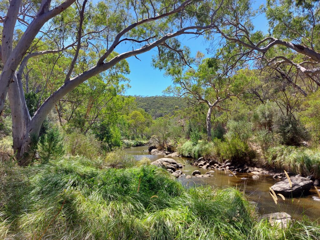
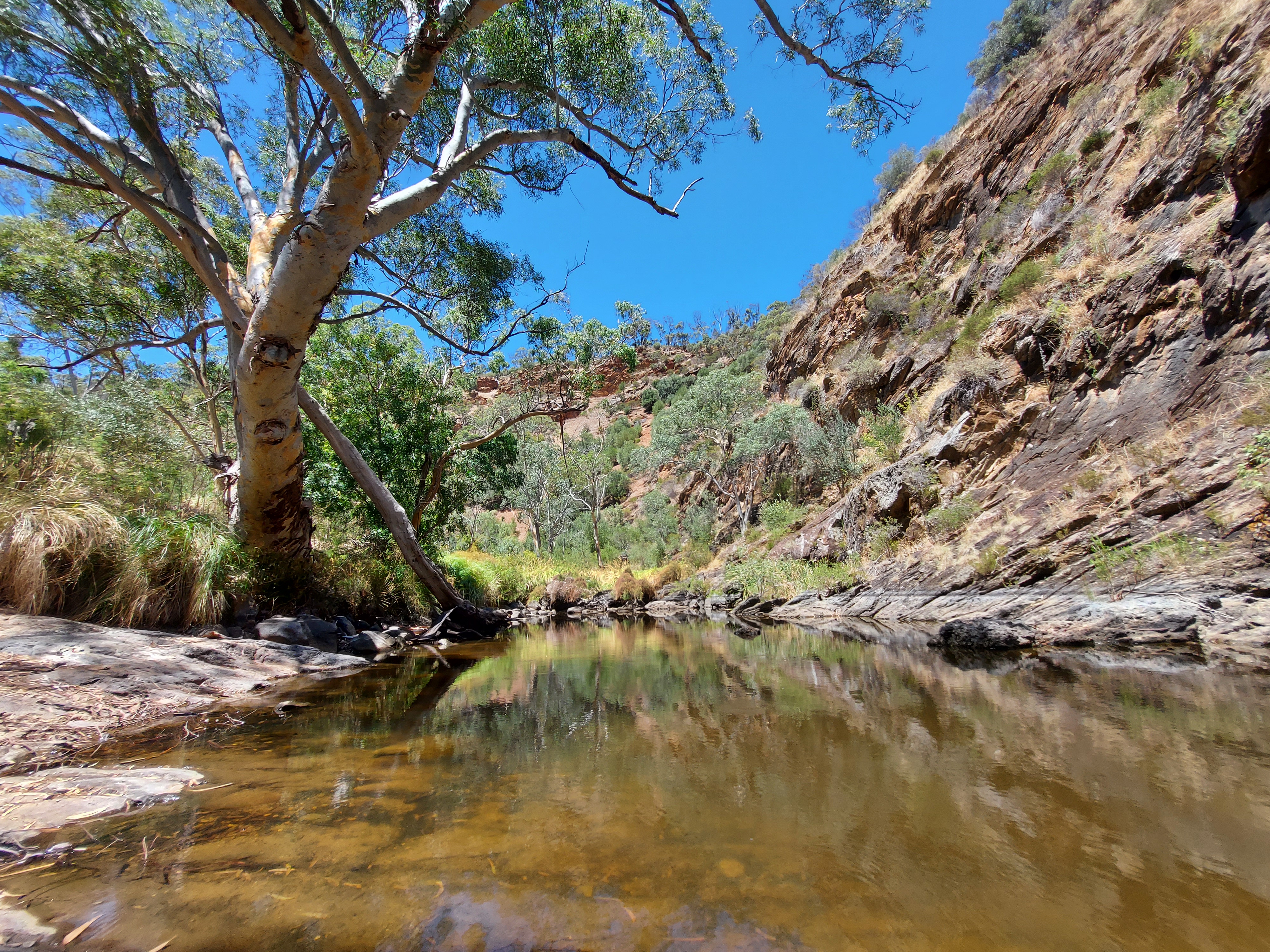
The scariest hike I have ever done so far. Well, perhaps it was because we went there in summer, and the tall grass area along the river made me imagine snakes lurking beneath my feet all the time. Start from the carpark, it’s a pretty pleasant path to Sundews Lookout before the rocky downhill to the bottom of the gorge. Then keep walking along the river for about 1.6 km. There is some point that you probably don’t know which way to go as it’s no obvious track, but keep going, walk through the bushing grass or climb over the rocks. Trying to look for a walking trail and follow it.
There are a couple points where you can admire the beauty of the gorge or dip your feet into refreshingly cool water at the waterholes. I recommend taking your time to relax and enjoy the gorge as much as possible because the uphill climb back to the car park is quite a workout.
It’s a 40 minute drive to the southeast from the city, using Southern Expressway, then turn onto Panalatinga Road and merge with Piggott Range Road to reach Gate 11 at Onkaparinga National Park.
- Distance: 5.8 km circuit
- Duration: 2-4 hours
- Difficulty: Hard
Your town’s nice! Would like to try all that hiking. 😍😍😍
It’s so beautiful here 🙂